1River and Estuary
Nanaimo River mainstem
Final 12 km of a 56 km river network.
Look for the heavy blue channel crossing the flats to the sea.
Open selected location in OpenStreetMap ↗Select a component to see what it means and where to look. Dashed or indicative areas are orientation points, not surveyed extents.
Final 12 km of a 56 km river network.
Look for the heavy blue channel crossing the flats to the sea.
Open selected location in OpenStreetMap ↗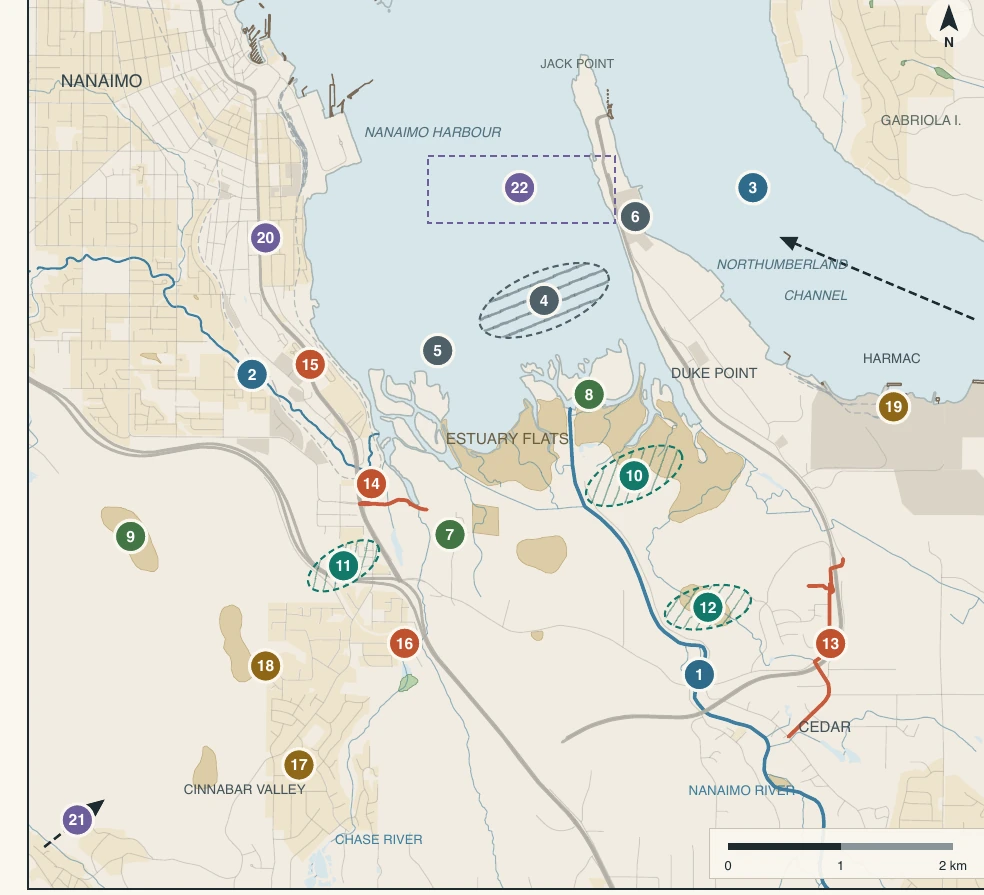
Booming ground sits above eelgrass and flats. Shading, scour and bark fall-out meet nursery habitat.
A low-lying road crosses the flats. One overtopping section closes the whole route, flooded or not.
Urban runoff discharges upstream of shellfish areas already closed to harvesting. Contaminants, not water, are the constraint.
Releases from Jump Lake and South Fork hold flows up for returning fish in dry months. The river is operated, not only observed.